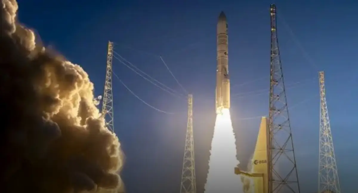
Sentinel-1D Earth observation satellite launched
The family is now complete

The Copernicus Sentinel-1D Earth observation satellite, built by prime contractor Thales Alenia Space (TAS), the joint company between Thales (67%) and Leonardo (33%), was successfully launched by Arianespace with an Ariane 6 rocket from Europe’s spaceport, in French Guiana (see AVIONEWS).
Sentinel-1D is part of Copernicus, the Earth Observation component of the European Union’s Space Programme. This program is managed by the European Commission and co-funded by the European Union and the European Space Agency.
With Sentinel-1D now successfully launched, the Sentinel-1 family is complete. As the final satellite in the first Copernicus constellation, Sentinel-1D will ensure continuity and enhance the missions in orbit, extending system operations for at least the next seven years and beyond.
The satellite captures images of Earth’s surface — day and night, in all weathers — for a wide range of applications to help protect our planet. This crucial data will be used to monitor landslides, earthquake zones, volcanic activity and variations in polar ice cover. They will also provide valuable insights for monitoring deforestation, the use of water resources and supporting emergency responders and search and rescue teams in the event of natural disasters.
Sentinel-1D, like Sentinel-1C, carries an Automatic Identification System (AIS) payload to enhance maritime safety — improving traffic management, preventing collisions and monitoring vessels in sensitive areas. It also introduces a world-first: a patented mechanism that separates the radar antenna from the spacecraft bus during end-of-life reentry, helping reduce orbital debris.
“I’m particularly proud of this successful launch — now the Sentinel-1 family is complete", said Giampiero Di Paolo, Deputy CEO and Senior Vice President Observation, Exploration and Navigation at Thales Alenia Space. “Our long-standing recognized expertise in developing radar-based Earth observation satellites is once again on orbit”.
“Over the years, our company has proven it has the capabilities required to meet this program’s technological challenges, fully aligned with Europe’s environmental policy goals and marking a new phase in our collaboration with the European Commission and ESA” Thales Alenia Space CEO Hervé Derrey said.
Thales Alenia Space’s role
As prime contractor for the Sentinel-1 mission on behalf of ESA, TAS is responsible for satellite design, development, integration and testing. Each Sentinel-1 satellite is built on the PRIMA spacecraft bus developed by Thales Alenia Space for the Italian Space Agency (ASI) and carries a Cband synthetic aperture radar (SAR) instrument developed by Airbus Defence & Space. This SAR instrument enables precise mapping at resolutions up to 5 meters and coverage out to 400 kilometers.
More about Sentinel 1
This mission comprises two satellites in Sun-synchronous orbit operating in tandem to provide optimal global coverage with a 12-day repeat cycle. Their pre-tasking capability means data can be acquired consistently over long periods, which is essential for analyzing environmental trends. This data is made available to public authorities, businesses and citizens around the world on a free, full and open basis.
With a launch mass of 2,184 metric tons, Sentinel-1D will operate in low-Earth orbit at an altitude of 700 kilometers and has a design life of seven years.
Leonardo contributed to the development of the Sentinel-1D and 1C satellites by supplying the attitude sensors (Autonomous Star Tracker) and power units for the radar, ensuring continuous availability of images.
Telespazio Germany supported the launch of Sentinel-1D and is providing assistance during the launch and early operations phase (LEOP) with regard to mission operations, ground segment services and software coordination.
Data from the Sentinel-1D satellite will be collected by several European centres, including the Matera Space Centre operated by e-GEOS, a joint venture between Telespazio (80%) and the Italian Space Agency (20%). The Centre is part of the ESA Core Ground Segment within the Copernicus Programme.
Copernicus
It is the Earth observation component of the European Union Space Programme, monitoring our planet and its environment for the benefit of all Europeans. It delivers accurate, timely and accessible information to improve environmental management, address climate change and support civil security. As the world’s most advanced Earth observation system, Copernicus provides continuous, free and reliable data and services to public authorities, businesses and citizens worldwide.
Copernicus comprises 12 satellite families and a suite of monitoring networks — such as ground weather stations, ocean buoys andair-quality networks — to deliver robust integrated information and calibrate and validate satellite data.
The satellites are built for ESA by European prime contractors. A program of this scale helps Europe anticipate the impacts of climate change and take action to protect our planet.
The program is managed by the European Commission and funded by the EU, with additional contributions from ESA.
Thales Alenia Space, a key Copernicus partner
TAS is a major contributor to 11 of the Copernicus program’s 12 missions. Sentinel-1 monitors land and sea in all weathers, day and night, thanks to its radar capabilities. Sentinel-2 and-3 acquire highresolution optical imagery over land and coastal waters. Sentinel-4 and-5 are dedicated to meteorology and climatology missions. Sentinel-6 monitors the planet’s oceans. As well as being prime contractor for the Sentinel1 and-3 satellite families, Thales Alenia Space also supplied the Sentinel-2 image ground segment and helped build the imaging spectrometer on Sentinel-5P and the Poseidon-4 radar altimeter on Sentinel-6. In 2020, TAS was awarded five contracts for the six new Copernicus Expansion missions, as prime contractor for the CIMR, ROSE-L and CHIME satellites and supplier of the CRISTAL and CO2M mission payloads. These new satellites will measure human-induced atmospheric carbon dioxide, survey sea ice and snow cover, support new optimized services for sustainable farming and biodiversity, observe sea-surface temperature and salinity as well as sea ice density and strengthen land monitoring and emergency management services.
AVIONEWS - World Aeronautical Press Agency